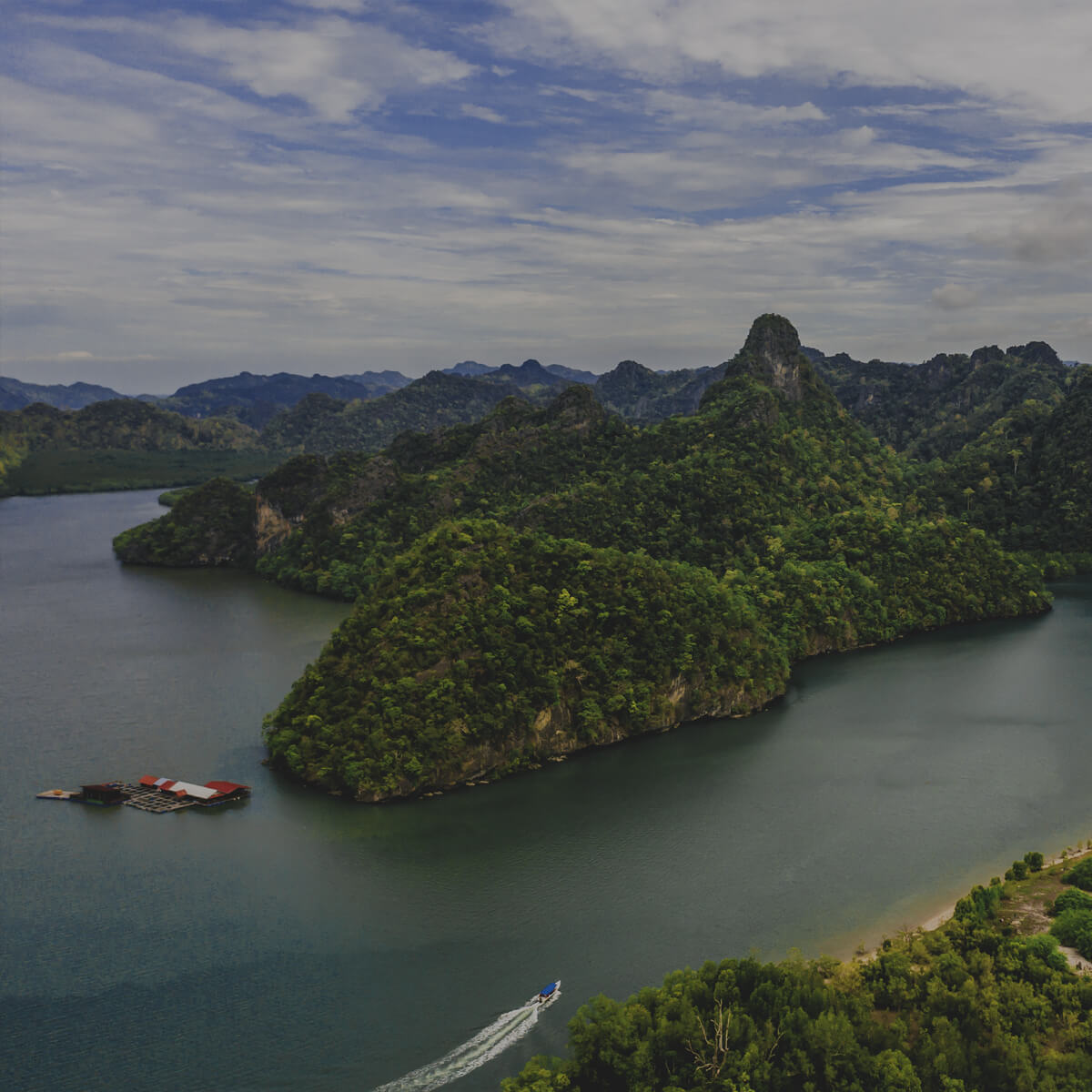
TANJUNG RHU KARST GEOSITE
Tanjung Rhu Karst is part of the Kilim Karst Geoforest Park, located in the northeastern part of Langkawi. Karst is a topography formed from limestone dissolution and is characterized by rough surfaces, hilltop towers, cone-shaped hills, dome-shaped hills (mogote), sinkholes and caves. The landscape takes up interesting shapes, such as a karst hill that looks like a sitting gorilla and Pulau Chabang sea stack. The beauty of the landscape here is also characterised by the formation of dunes, sand beds and Tanjung Rhu river.
This river, that is influenced by the tides forms an extensive mudflat covered by pristine mangroves. The hills, on the other hand, are covered with limestone forests with plants that are tolerant to extreme conditions, such as scorching heat, strong winds, thin soil and scarce water. An interesting limestone plant species here is Paraboea spp., which is a bioindicator of a limestone habitat. More than 80% of the community at Tanjung Rhu relies on tourism and fisheries. Tanjung Rhu Fisheries Resources Management (KPSP) is actively involved in the operation of Tanjung Rhu Geotrail, floating seafood restaurants and fish farming.