Langkawi UNESCO Global Geopark (LUGGp)
Recognized by UNESCO in 2007, Langkawi became one of the first geoparks in Southeast Asia, thanks to its rich geological history, biodiversity, and commitment to sustainable development. Spanning over 480 square kilometers, the geopark covers the entire Langkawi archipelago, which includes 99 islands off the northwest coast of Malaysia, and is renowned for its rare geological formations, pristine ecosystems, and cultural heritage.
Langkawi UNESCO Global Geopark, located in the far northwestern corner of Peninsular Malaysia in the state of Kedah, spans an impressive area of approximately 478 square kilometers of land and, including water bodies, covers a total area of 920 square kilometers. It is renowned for its rich geological heritage and stunning natural landscapes, pristine ecosystems, and cultural heritage. Established on 1st June 2007, it holds the distinction of being Southeast Asia’s first UNESCO Global Geopark and the birthplace of Malaysia.
The geopark encompasses several notable conservation areas and trails, including the Machinchang Cambrian Geoforest Park, Kilim Karst Geoforest Park, Dayang Bunting Marble Geoforest Park, Tuba Geotourism Trail, and Kubang Badak Biogeotrail. These areas showcase a diverse range of geological formations, from ancient rock sequences to unique karst landscapes, offering visitors a glimpse into Earth’s early history.
Each of these geoforest parks showcases significant geological, biological, and cultural heritage. With an abundance of natural wonders, from ancient rock formations and dramatic mountain peaks to a wealth of flora and fauna, the Geopark experience is one not to be missed. So keep your eyes open and your camera ready!
Beyond its geological significance, Langkawi UNESCO Global Geopark is celebrated for its biodiversity, featuring mangrove forests, caves, and a variety of flora and fauna. It serves as a model for conservation and sustainable tourism, inviting visitors to explore its natural wonders while promoting environmental education and community engagement.
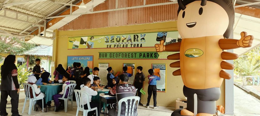
MEET OBIT
OUR OFFICIAL LANGKAWI UNESCO GLOBAL GEOPARK MASCOT!

Fun Facts About Obit
- He is named after the trilobite, an ancient fossil arthropod, one of the earliest and longest-living marine species, which flourished across vast oceans for nearly 300 million years.
- His kind thrived at the dawn of the Palaeozoic Era (often referred to as the Trilobite Age), which goes back over 550 million years.
- His top part is a carapace or hard crustacean upper shell, while the lower part is divided longitudinally into three lobes (hence, ‘tri-‘ and ‘lobite’).
- He represents the oldest fossil in Malaysia, the saukiid trilobite, which can be found within the Machinchang sandstone.
As a symbol of Langkawi Geopark, Obit embodies the island’s rich geological heritage and the ancient history preserved within its landscapes. The mascot serves to educate and engage visitors, highlighting the significance of Langkawi’s natural wonders and the importance of preserving its unique geological and ecological features.

GEOLOGICAL HISTORY OF LANGKAWI
Langkawi archipelago boasts the oldest and most complete Palaeozoic (540 million to 250 million years ago) geological record in the region. Since the early Cambrian period, Langkawi has undergone various geological processes, within different environments, resulting in numerous types of sedimentary rocks with interesting and unique structures, and containing a likewise variegated assortment of fossil types.
The first major depositional event took place in a shallow marine deltaic and fluvio-marine environment believed to be what was once part of the continental shelf of the supercontinent Gondwanaland. This deposition, dominated by sandstones, is known as the Machinchang Formation. Following these deltaic deposits, there was a period of marine transgression that caused the deposition of calcium carbonate-rich sediments. These lithified into shallow to deep marine limestones, Setul’s Lower Detrital Member, during the Ordovician and Silurian. This was followed by marine regression, seen today in the Upper Detrital Member, which shows shallow marine limestones. There was then a short period of no deposition in the Middle Devonian, followed by the deposition of the basal redbeds, then mud and siltstones of the Singa Formation.
These all show the influence of polar glaciation and melting with the appearance of dropstones and cold-water fossils. During the Permian, Langkawi and its Sibumasu Terrane broke away from Gondwanaland and drifted north to warmer latitudes, which led to the deposition of the tropical Chuping Limestone.
The Sibumasu Terrane drifted until it collided with Indochina, causing the deposited and lithified sedimentary rocks to be subject to major tectonic movement, resulting in faults and folds throughout the region. Concurrently, magma was emplaced in various granite bodies. This tectonic episode, through uplift, brought Langkawi to the surface from beneath the ocean, resulting in the rocks undergoing continuous erosion, creating the unique geological landscape we see.
